
 By Dwi Wanna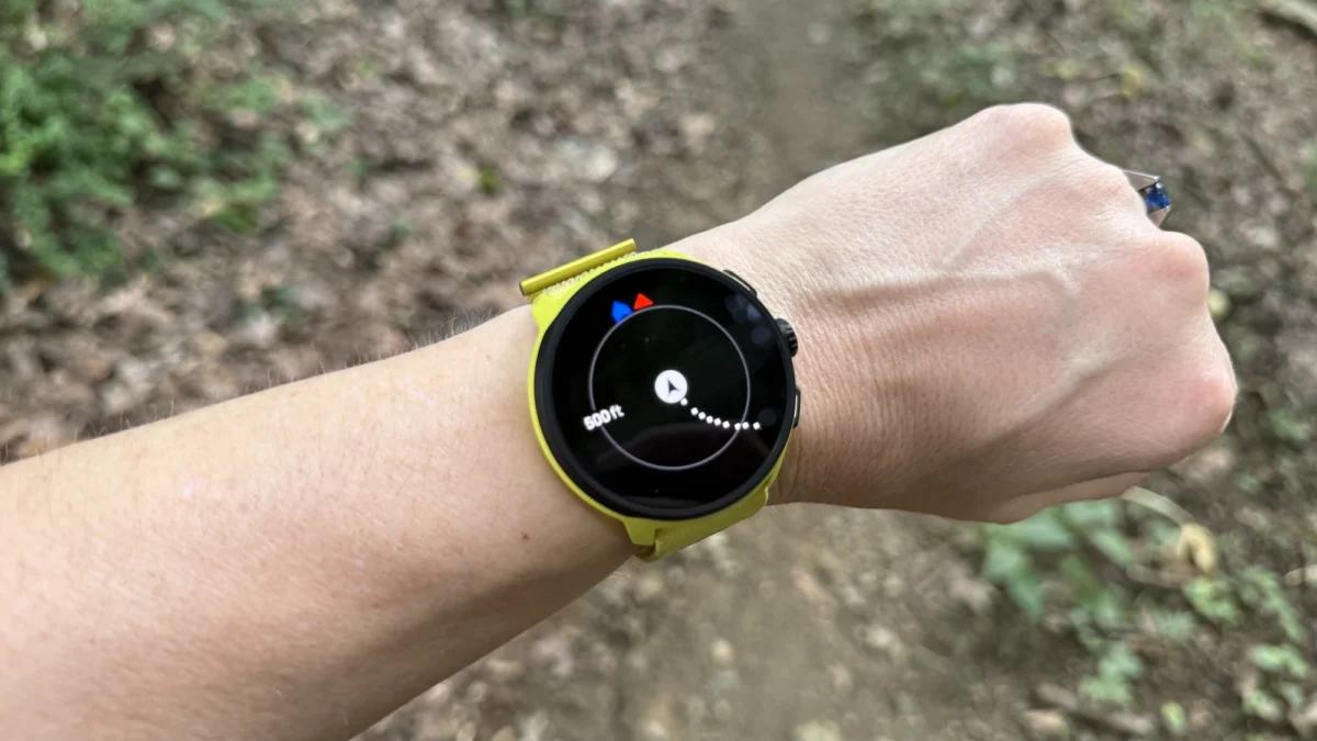
For decades, the luxury of looking down at a detailed, full-color topographic map while huffing up a mountain trail or navigating an unfamiliar urban marathon route was reserved for the most dedicated elite. It demanded a heavy, thousand-dollar wrist-mounted computer—devices like the top-tier Garmin Fenix series. For runners and hikers shopping on a budget, navigation meant a blank screen tracking a single, lonely digital line, leaving them guessing whether that intersection ahead was a highway overpass or a dead-end driveway.
That paradigm is shifting rapidly. Thanks to a combination of more efficient software, cheaper flash storage, and fierce competition across the wearable tech market, true offline mapping is finally trickling down to mid-range and even entry-level sports watches. You no longer need to empty your savings account to know precisely where you are in the world, completely untethered from your smartphone.
Main Facts: Untangling GPS, Breadcrumbs, and True Maps
To understand the magnitude of this shift in the running watch market, consumers must first understand what they are actually paying for. Fitness tech marketing departments love to blur the lines between "GPS tracking," "breadcrumb navigation," and "offline maps." In reality, they are three entirely different tiers of technology.
1. GPS Tracking: Where You Are
Every modern running and hiking watch features GNSS/GPS capability. This simply means the internal hardware can lock onto global satellites to determine your geographic coordinates in real-time. This data powers your live pace, distance traveled, and overall speed. However, cheaper or specialized wearables—such as certain ultra-minimalist recovery trackers or older smartbands—rely on the GPS chip inside your paired smartphone rather than housing an onboard chip.

Crucially, standard GPS tracking does not mean you can see a map while you move. Instead, the watch logs your coordinates in the background. Once you finish your workout and sync the device to your phone, your route is overlaid onto a map downloaded from the internet.
2. Breadcrumb Navigation: Where You’ve Been (or Plan to Go)
A step up from basic tracking is breadcrumb navigation. On these devices, the screen displays a line representing your path on a completely blank, featureless background.
Users can often download a predefined "course" or "route" file to the watch. The device will then display a line showing where you are supposed to go, layered against the line of where you actually stepped. Many modern watches can even generate basic turn-by-turn alerts from these files. The limitation? The watch has zero context about the physical world. It does not know that your digital trail intersects with a river, a private fence, or a major highway.
3. Offline Maps: What Exists Around You
This is the holy grail of outdoor navigation and the focus of this report. Watches equipped with full offline maps do more than trace a line in a void; they render the world around you. Running down Main Street? Your watch shows you the street name, the impending bridge, and the nearby topographical contours.

These maps make route-following exponentially easier because users can visually cross-reference their position with permanent landmarks like lakes, parks, and major roads. While high-end models from brands like Garmin and Amazfit can generate complex routes directly on the watch hardware, most mid-range devices simply render the map as an interactive background graphic underneath your breadcrumb route.
Because maps take up considerable data storage space, users must typically download localized map files via their phone’s companion app while connected to home Wi-Fi before heading out on a trek. Once downloaded, however, these maps remain permanently stored on the device for repeated offline use.
Chronology: The Evolution of Wrist-Based Cartography
The road to affordable wrist-based cartography has been a gradual, hardware-driven marathon rather than a sudden sprint.
- The Pre-2020 Era (The Monopoly of Expense): For years, built-in topographic mapping was strictly the domain of heavy-duty outdoor adventure watches, pioneered by Garmin’s Fenix line and specialized hiking units. Prices routinely hovered between $800 and $1,200. These watches required massive internal storage chips and robust processors, making them far too bulky and expensive for everyday runners.
- The Software Unlock (2022–2023): As flash storage became exponentially cheaper and microchips more power-efficient, manufacturers began experimenting with software updates. Rather than launching entirely new hardware lines, brands realized they could optimize memory management to inject map data into existing chassis.
- The Mid-Range Revolution (2024–Present): The dam finally broke. Brands like Coros proved that software optimization could bring offline mapping to sub-$300 devices, while budget competitors like Amazfit slashed price points even further. Today, consumers have viable, road-tested options spanning from $170 to $750.
Supporting Data: The Current Landscape of Mapped Watches
Extensive road-testing by fitness gear experts reveals that today’s market offers distinct tiers of mapped watches tailored to different budgets and use cases. Below is a breakdown of the current market leaders.

| Brand & Model | Price | Map Type & Storage Limitations | Key Strengths |
|---|---|---|---|
| Garmin Forerunner 970 | $750 | Full-feature topographic maps; expansive regional storage. | The gold standard of sports tech; highly detailed, highly responsive, includes a built-in flashlight. |
| Suunto Run 2 | $399 | Mid-range regional maps with clear directional guidance. | Excellent value for the mid-tier; crisp turn-by-turn arrows and reliable performance. |
| Suunto Race 2 | $499 | High-performance outdoor maps. | Premium outdoor aesthetics and robust battery life paired with fluid map rendering. |
| Coros Pace 4 | $249 | Lightweight localized maps (e.g., handles states, not countries). | Incredible value; recently updated via software to include maps without sacrificing its featherlight running build. |
| Amazfit Active Max | $170 | Budget offline maps on a bright, large display. | Unbeatable price point for users demanding a map on a strict budget. |
The Garmin Forerunner 970 ($750): The Benchmark
Garmin remains the undisputed heavy-weight champion of the running watch ecosystem, renowned for its polished interface and exceptionally detailed cartography. Historically, Garmin locked maps behind its ultra-expensive Fenix or high-end Forerunner series.
The Forerunner 970 serves as the current baseline for Garmin’s map-equipped tier. While the sticker shock is real, the watch delivers professional-grade mapping, deep training analytics, and even a built-in flashlight. Buyers should note Garmin’s strict nomenclature: any Forerunner model starting with a "9" (such as the 970, 965, or 955) includes full maps. Models starting with other numbers (like the 165 or 570) are restricted to basic breadcrumb navigation.
The Coros Pace 4 ($249): The People’s Champion
For years, the Coros Pace series was celebrated as the ultimate minimalist running watch—lightweight, endlessly functional, and remarkably affordable. The introduction of offline maps via a software update fundamentally changed the value proposition of the Pace 4.
Storage space is the primary compromise here; you can comfortably store detailed maps for a region or a state like Pennsylvania, but you cannot download the entire continental United States. For 99% of runners, this limitation is entirely negligible, making it arguably the best all-around running watch on the market.

The Suunto Run 2 ($399) and Race 2 ($499): The Mid-Range Contenders
Suunto occupies the sweet spot for athletes who want robust outdoor features without paying Garmin prices. The Run 2 ($399) and its sibling, the Race 2 ($499), offer clear directional arrows when following downloaded routes and highly legible mapping software. Testers praise Suunto for keeping map rendering smooth and uncluttered during high-speed trail runs.
The Amazfit Active Max ($170): Maximum Features, Minimum Cost
Zepp’s Amazfit brand has built its reputation on a singular mission: packing premium specifications into aggressively budget-friendly hardware. The Active Max brings offline mapping to a large, vibrant screen for under $200.
However, users must accept compromises. While accuracy and core metrics hold up well under testing, Amazfit’s ecosystem lacks the refined polish of Garmin or Coros. Companion apps can feel slightly clunky, and the watch interface occasionally suffers from minor input lag. Nevertheless, for budget-conscious beginners who refuse to run without a map, it represents an incredible bargain.
Official Responses and Industry Insights
Industry analysts note that the democratization of GPS mapping on wearables is a direct response to consumer demand. As trail running, ultramarathons, and gravel cycling surge in popularity, outdoor enthusiasts are venturing further off the beaten path than ever before.

"We are seeing a definitive shift away from the phone-tethered workout," notes a leading fitness tech product manager who spoke on condition of anonymity. "Consumers want independence. They don’t want to pull out a smartphone in the middle of a freezing downpour or a grueling mountain climb to check a trail fork. The wrist is becoming the ultimate heads-up display."
Furthermore, manufacturers have realized that holding back fundamental navigation features in an era of intense competition is a losing strategy. By trickling maps down to sub-$300 devices like the Coros Pace 4, brands are successfully capturing a massive demographic of casual runners and hikers who previously felt priced out of the advanced gear market.
Implications: What This Means for Runners, Hikers, and the Tech Market
The arrival of affordable offline mapping carries several profound implications for both consumers and the wearable technology industry at large.
- Enhanced Safety on the Trails: Perhaps the most vital implication is user safety. Getting lost during a winter run or an isolated mountain hike can quickly turn dangerous. Putting topographic data directly onto a runner’s wrist drastically reduces the risk of disorientation, even if a phone battery dies or cellular service drops entirely.
- The Shrinking Value Gap for Luxury Wearables: As mid-range watches ($250–$400) absorb features that once cost $1,000, high-end brands must work harder to justify their pricing. Luxury devices now rely less on essential software features like maps and more on premium physical materials (titanium bezels, sapphire crystal glass) and hyper-specialized physiological sensors.
- Storage and Battery Trade-Offs: As consumers embrace cheaper mapped watches, they must also navigate the physical limitations of smaller devices. Storage constraints mean runners must be strategic about which regional maps they download. Furthermore, actively rendering a map canvas while pulling continuous GPS data places a heavier tax on battery life, pushing manufacturers to continuously improve power management efficiency across entry-level silicon.
Ultimately, the era of the blind running watch is coming to a close. Whether you are dropping $750 on a Garmin powerhouse or picking up a $170 Amazfit for weekend jogs, the map of the world is officially shrinking down to fit comfortably around your wrist.
 Layla Zulfa
  Asro
Asro  Reynand Wu