
 By Asep Darmawan
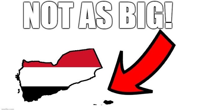
It is a cornerstone of modern geography: every nation has a defined, measurable area. We trust that international bodies, encyclopedias, and government databases have accurately calculated the sovereign territory of every country on Earth. However, a recent investigation into the borders of Yemen has revealed a startling truth: for over a century, the reported size of this nation has been significantly inflated, propagated by a cascade of unverified data, administrative errors, and academic inertia.
The discrepancy was brought to light not by a government surveyor, but by a curious observer who received a skeptical comment on a video production. Upon cross-referencing the widely accepted figure of 555,000 square kilometers with a manual reconstruction of Yemen’s borders using modern satellite mapping, the results diverged sharply. The calculated reality—approximately 456,000 square kilometers—suggested that nearly 100,000 square kilometers had been "invented" by statistical tradition.
The Anatomy of an Error: Main Facts
The primary claim—that Yemen spans 555,000 square kilometers—has been cited by Wikipedia, various statistical yearbooks, and international reporting agencies for decades. Yet, when plotting the internationally recognized borders defined in the 2000 treaty with Saudi Arabia against high-resolution satellite imagery, the math fails to hold up.
The investigation into the origins of this figure points toward two distinct historical errors that, when combined during the 1990 unification of North and South Yemen, created a "super-error." These inaccuracies were not the result of shifting tectonic plates or territorial acquisition, but rather the result of lazy data compilation—where outdated figures were treated as gospel for over a century without a single rigorous audit.
A Chronology of Fabrication
To understand how such a massive error persisted, one must look at the historical context of the two Yemens before their 1990 unification.
The North Yemen Phantom
The story of the North begins in 1904. The New International Encyclopedia of that year provided an estimate for the "Yemeni Vilayet," a province of the Ottoman Empire. At that time, the administrative boundaries of the Ottoman province were vastly larger than the modern-day sovereign state of North Yemen. Despite the fact that the actual territory of the independent North Yemen was roughly half the size of that old Ottoman province, reference books continued to cite the 1904 figure (195,000 square kilometers) in every subsequent edition. By the time of the 1964 Statesman’s Yearbook, this number was firmly cemented in the global consciousness, effectively "ghost-writing" the geography of a modern nation using colonial-era statistics.

The South Yemen Double-Count
The error concerning South Yemen is arguably more bizarre. For years, sources reported its size at 287,000 square kilometers. However, a 1976 World Bank report on the economic situation of South Yemen introduced a new figure: 338,100 square kilometers.
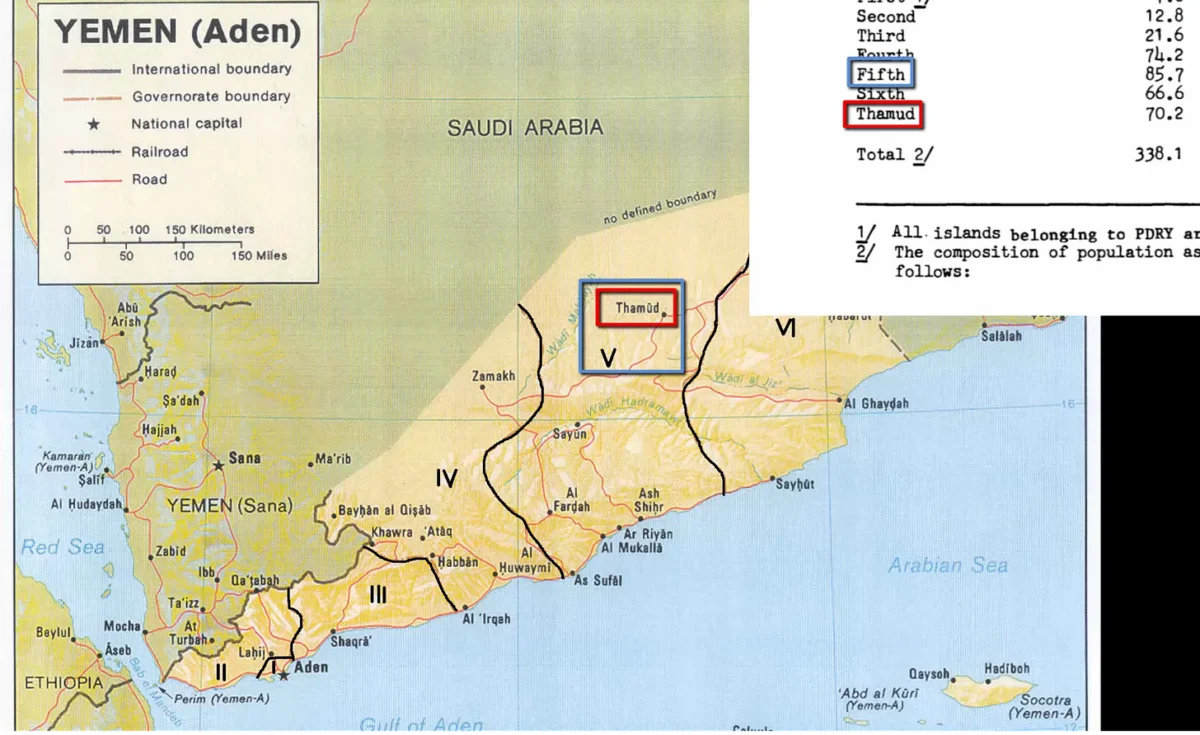
A granular investigation of the report’s 51st page reveals a technical blunder: an administrative region known as "Thamud" was counted as a standalone governorate while also being included as a subset of the Fifth Province. This double-counting of territory created a synthetic expansion of the nation’s borders. Once published in a prestigious World Bank document, this inflated number was adopted by the CIA World Factbook, the United Nations, and Encyclopedia Britannica.
Supporting Data: The Discrepancy in Numbers
The persistence of these figures in the face of modern satellite technology is a case study in institutional inertia.

- North Yemen: Historically cited as 195,000 km², compared to a modern satellite-verified measurement of approximately 136,000 km².
- South Yemen: Historically cited as 332,968 km² (following the 1976 error), compared to a verified measurement of roughly 288,000 km².
- United Yemen: The total of 555,000 km² is a simple, erroneous sum of these two inaccurate parts.
When researchers attempt to reconcile these numbers, they find that even the most "reliable" sources, such as the CIA World Factbook, often display historical baggage rather than current reality. The Factbook’s own records show a sudden, inexplicable jump in the size of South Yemen in 1986, reflecting the adoption of the flawed 1976 World Bank report.
The Role of Propaganda and Border Ambiguity
Before the 2000 Border Treaty with Saudi Arabia, the frontier between the two nations was not clearly demarcated, particularly in the vast, arid reaches of the Rub’ al Khali (Empty Quarter) desert. During this era of ambiguity, it is highly probable that state officials, perhaps for nationalistic or propaganda purposes, drew the northern borders to the 20th parallel to maximize the country’s reported size.
When these "aspirational" borders were used to generate official statistical yearbooks in the early 1990s, the myth became official state policy. Geography, in this instance, became a tool of projection rather than a reflection of land occupancy.

Implications: The Cost of Institutional Inertia
The implications of this finding are profound. First, it highlights the "copy-paste" culture of global data aggregation. When a primary source—like the World Bank or the CIA—publishes a figure, it is rarely questioned by secondary sources. This creates a closed loop of misinformation where the wrong number becomes the "truth" simply by virtue of repetition.
Furthermore, this error affects more than just school textbooks. Environmental studies, resource allocation, and international aid distribution are all predicated on the accurate measurement of a nation’s landmass. If a country is significantly smaller than its official statistics suggest, then density-based metrics—such as population density, agricultural output per square kilometer, and natural resource distribution—are fundamentally skewed.
A Call for Institutional Correction
The fact that this error has gone unchallenged for nearly 100 years is a sobering indictment of modern fact-checking in the sciences. It suggests that while we have the technology to map the Earth to the millimeter, we lack the institutional will to update our fundamental records when errors are exposed.

As the digital age continues to prioritize speed over accuracy, the "Yemen Case" serves as a reminder that even the most basic facts are subject to the decay of time and the corruption of human error. It is time for international bodies, from the United Nations to the World Bank, to conduct a comprehensive audit of their geographic databases.
The question remains: will these institutions acknowledge the century-old mistake, or will they continue to prioritize the preservation of their legacy data over the truth? The evidence is clear, the satellite maps are available, and the error is documented. All that is required now is the institutional courage to correct the map. The story of Yemen’s size is a powerful call to action for every researcher, geographer, and citizen to never take "official" data at face value—because sometimes, even the largest facts on the map are built on the smallest of errors.
 Sagoh
 Pevita Pearce
 Layla Zulfa
